|
HIKE
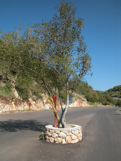
The Brilliance of Mt. Meron
Countless holy people have found
shelter in the hills of Mt. Meron. The graves of the righteous dot the
refreshing green landscape. A route for experienced hikers leads from
the grave of Rabbi Shimon Bar Yochai to the Elkosh Bridge by Hurfeish.
Text and Photography: Ya’acov Shkolnik
The campground by
the riverbed of Nahal Meron is an excellent starting point for a hike.
The only problem with this campground is that it lies in the only bend
on Route 85, which ascends from Parod to Meron, and so it only can be
entered from one side of the road – the side leading from Meron. Other
than that, everything else is ideal. There are tables, water sources,
and shade from the trees.
Start the hike from
the top of the path (with blue trail markings) that runs alongside the
river. After roughly 200 meters, ascend the slope on the right along the
trail (with black trail markings) that leads to the grave of Rabbi
Shimon Bar Yochai. Since this hike is a long one, it is best to visit
the grave at another time and continue to the parking area beside the
yeshiva. A sharp eye can discern that, just at the point where a paved
road leaves the parking lot, an old staircase twists to the left. This
is the site of the ancient Meron synagogue, an important spot to visit,
even in our limited time.
 This
synagogue was built in the third century to serve the Jews of Meron. The
builders made good use of the natural rock, turning it into the
synagogue’s western wall and floor. The façade, which is still intact,
has three openings and its simple decorations complement the area’s
landscape. Behind the façade are both remains of and signs of the bases
of the pillars that once stood here. According to a local legend, if the
cracked lintel above the doorway falls, it is a sign that the Messiah
will arrive soon. Since there is no lack of signs that the Messiah will
turn up any day now, somebody has reinforced the lintel. This
synagogue was built in the third century to serve the Jews of Meron. The
builders made good use of the natural rock, turning it into the
synagogue’s western wall and floor. The façade, which is still intact,
has three openings and its simple decorations complement the area’s
landscape. Behind the façade are both remains of and signs of the bases
of the pillars that once stood here. According to a local legend, if the
cracked lintel above the doorway falls, it is a sign that the Messiah
will arrive soon. Since there is no lack of signs that the Messiah will
turn up any day now, somebody has reinforced the lintel.
The synagogue rests
on elevated rock, providing a view of the graves of the righteous that
are scattered here in abundance. Since time is short, just take a quick
look, descend again to the path, and hike northward about 500 meters,
until the gate of the fence which extends along the left side of the
path. Beside the gate there is a wicket that marks the beginning of the
path. This path leads through a wonderful grove with everything that you
would wish for: moss in the shadowy places and grasses and flowers (that
blossom late in the spring).

When you leave the
grove, the view of the green wall of Mt. Meron blocks the sky. The climb
upwards to bypass the saddle that separates Mt. Meron and Mt. Bar Yochai
looks like a suicidal feat, but the path here was created in the days of
the British Mandate, when there was respect for the natural outline of
the land. The result is a path, which is reinforced at some points, that
overcomes the great divide of almost 400 meters with much logic and
patience. So, the going is not difficult at all.
During the climb,
the view is gradually revealed (providing a great excuse for a rest-stop
once in a while). At the foot of Mt. Meron is Moshav Meron and beside it
two small settlements: Bar Yochai and Or Ganuz. There also is a great
view of Gush Halav and what used to be Sifsufa (the residents lobbied to
change its name to Kfar Hoshen). You also see Mt. Puah and Kibbutz Baram.
Higher up, you can spot Safed, Mt. Hermon, Ramat Dalton, and the large
drainage basin of the Dishon River, which drains the eastern part of the
Meron Mountains. Unfortunately, the greenery here has been scarred by
the recent war. Many of the rockets the Hizbullah fired landed in this
area and caused forest fires.
...
If you want to see
the entrance to Jermak’s Huta, turn left onto the dirt road and walk for
about five minutes. The word huta is a nickname that hikers use to
describe large pits, formed by water eating into soft rock over many
years. The pits can be dozens of meters deep. Huta probably is a
bastardization of the Arabic word hawa, which means abyss.
There’s an iron
fence in front of the entrance to Jermak’s Huta to prevent careless
hikers from falling into the 150-meter-deep pit. There are many fables
about this pit. In Beit Jann, they say that in Ottoman times, the
residents of the village refused to pay taxes and would throw the tax
collectors down this pit. When the local governor in Safed realized that
the tax collectors were disappearing, he sent his soldiers to find them.
The soldiers soon discovered what was happening and in retaliation
raided the nearby village of Jermak and threw all of the residents they
caught into the pit. And that, according to the fable, was the end of
the village of Jermak.
Jermak’s Huta
contains stalactites, stalagmites, fissures, and caverns. Rare species
of bats have been discovered here, including the long-fingered, greater
horseshoe, serotine, and common pipistrelle. In order to protect both
the natural environment and the visitors, entry is prohibited.
...
Just after the
riverbeds meet, follow the green trail markings and turn left along
Nahal Keziv. Between here and the Elkosh Bridge, we pass more than a few
cows, who enjoy chomping on the grasses by Nahal Keziv. We soon reach
Ein Hotam (Ein Elmazarib), which flows from a small structure with a
carved opening leading to a large basin. Beside it, a tiny stream flows
from a crevice in the rock and into the same basin. A large terebinth
tree grows out of the same crevice.
The rest of the path
is an easy stretch. As we walk, we see the sewage water from Beit Jann
trickle across the earth until it is absorbed. We also see clearer water
that bursts forth from time to time in the channel, creating springs
such as Ein Zevul, Ein Retet, and Ein Tabba’at. We continue on to the
Elkosh Bridge, which is adjacent to the Hurfeish soccer field and the
endpoint of our hike.
The full
article
appeared in ERETZ Magazine 105. To read it, subscribe to ERETZ Magazine.
|